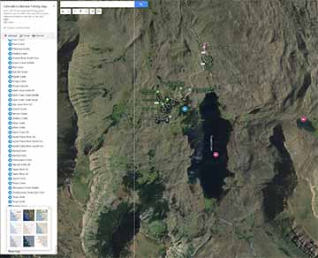
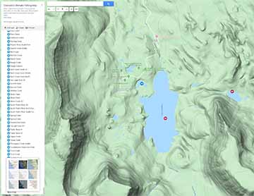
OUTWESTWOODS

Logo - "Get Out There"

About Colorado's Ultimate Fishing Map

Viewing The Map

With over 1000 fishing locations all those fish icons can be a bit of challenge to view on Google Maps, but these few tricks will help.

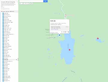
First, please make sure to view the map in full screen mode. That square thing in the upper right. (hit the [ ]). Then zoom in and out.  

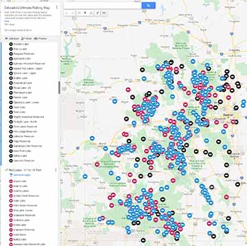
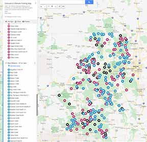
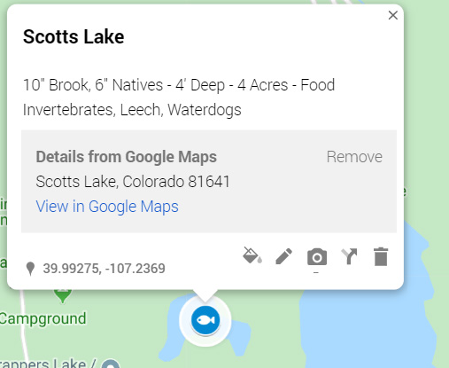
Second, there are two types of fish icons, lakes and streams. 

Third, you will notice there are three different colors of fish icons for different size fish found. Black (biggest), red (medium), blue (smallest). 

Since the fish are typically larger in the lakes than the streams I use a little different criteria for fish size. For example, blacks being bigger in lakes than streams. 

Average fish size for each lake and stream comes from net and creel checks done by the Colorado Division of Wildlife. 

 Some of this information is decades old but despite this much of the data is very accurate due to the fact there is low fishing pressure on most high-country lakes and streams. 

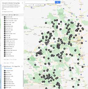
Note: If a lake or a stream is not listed then chances are the fish documented there were smaller than 10” in the lakes, and smaller than 8” in the streams. I would say out of the 1400 lakes & 1700 streams I looked at 10% had no data at all. 

Now, this does not mean you cannot catch a nice large trout in a stream not listed or a large fish listed in a lower rated lake or stream as this data is based on average fish size. 

Many of the lakes on the front range are not mentioned as this map focuses on trout fishing. 

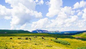
The goal of my map is to point you in the right direction with over 1000+ excellent Colorado lakes and streams to trout fish.

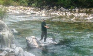
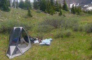
Remember, great fishing means great camping, hiking, backpacking, photography, bike riding and more.

More About Colorado's Ultimate Fishing Map

Filter The Fish Icons

You can change the levels to filter the lakes and streams. 

For example, you can look at just black lakes, or all lakes, or all streams, or just red streams and so on. 

Some examples below.

Select all lakes

Select all streams

Select all black lakes and streams

Get Lake and Stream Stats

If you click on the fish icons for each lake and stream you will see statistics like fish size, type, depth, stream width, food sources and more. 

Google maps may even give you a picture of the lakes.

Some examples below.

Try Different Map Modes

There is satellite, topo and more.

Some examples below.

View map in satellite mode

View map in topo mode

Last Note About Colorado's Ultimate Fishing Trip

Please consider Google Maps does have mistakes, like the placement of lake names at times (the Grand Mesa area is particularly bad)

I have tried my best to identify and label these lakes, but at times these small remote lakes can be a challenge. 

In saying this please check other sources before heading out into the woods to find any remote mountain lake or stream. 

Thank You for Using Colorado's Ultimate Fishing Map

More To Discover At OutWestWoods

Below are tips and tricks for fishing, surviving, preparing, and more. 

Colorado’s small mountain streams are perfect for ultra light lure fishing. I share my sure fire techniques here. 

Here is my backpacking equipment list that I developed over many years. I hope it can help ready you as it has readied me. 

Detailing some of the amazing backpacking trips I have done over the decades. I spent countless hours researching and backpacking some of Colorado’s most amazing high country locations.

Sharing my 25 years of tips and tricks for Colorado’s high country. I hope you find some good ideas here. 

Please see Eseta Mines for jewelry, displays, crystals, mine tours, mine location and filing services.

Let me know if I can give you any help. 

Fellow Outdoorist: 2317
OutWestWoods

FREE
VIEW